Wildfire response
Airspace awareness for wildfire response
Wildfire air operations run low, fast and close to the fire, often inside a temporary flight restriction. PerimeterScope puts crewed aircraft and drones on one live map, on scene, in real time.
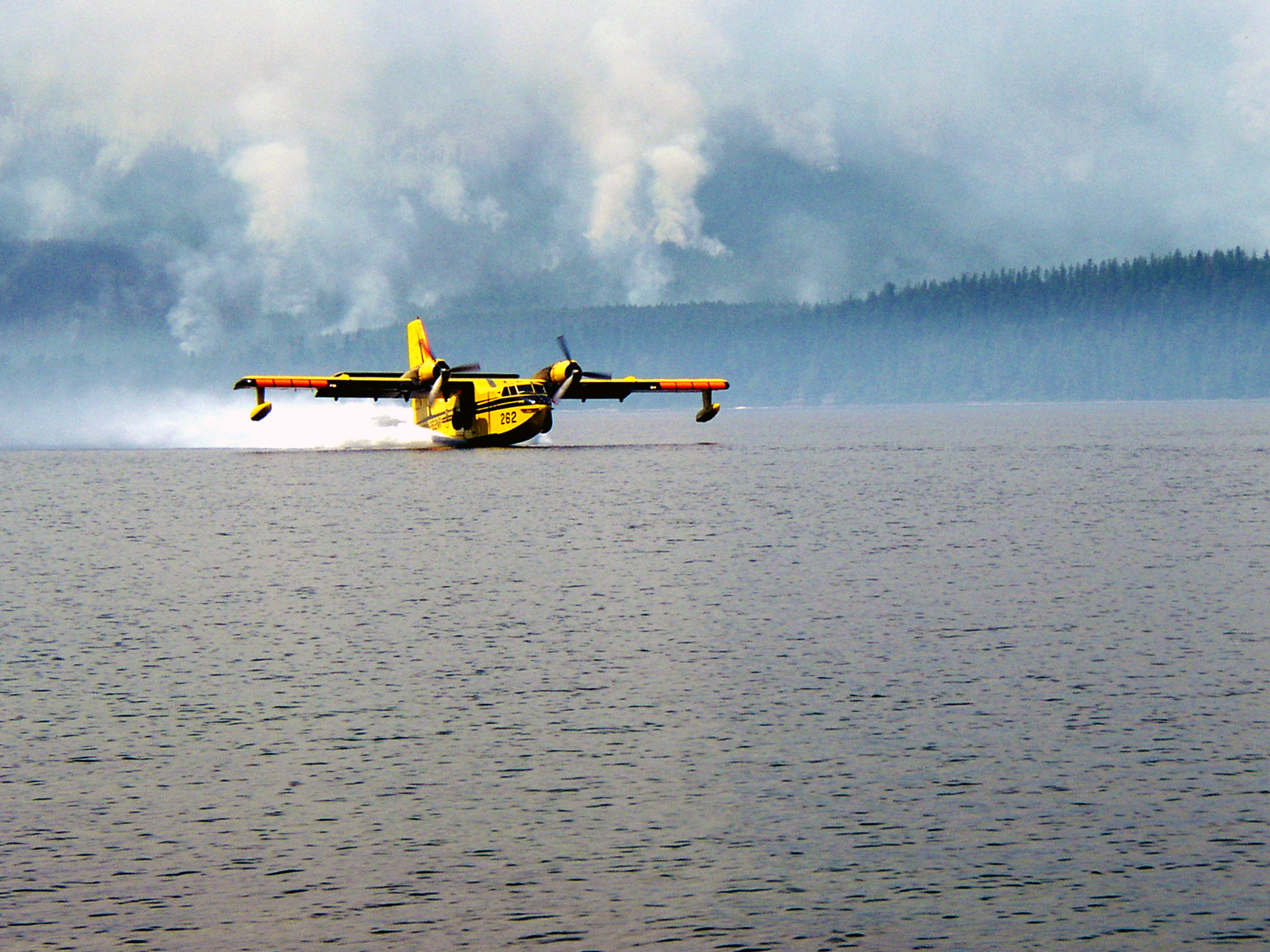 National Park Service
Why wildfire airspace is hard
Helicopters, air tankers, scoopers and air attack aircraft work the same smoky sky, low over the terrain and close to one another. Most fires have no tower and no radar. A temporary flight restriction is supposed to keep everyone else out, but a drone pilot may not know it exists, or may fly in anyway. When a drone shows up, the safe call is to stop flying, and every minute the aircraft sit on the ground is a minute the fire keeps growing. Cal Fire has said that grounding all aircraft after a drone report can take anywhere from 15 minutes to half an hour. DroneDJ
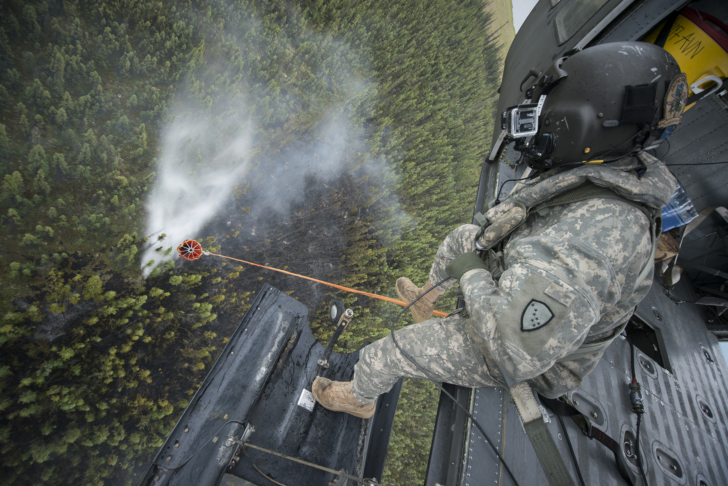 Photo by Sherman Hogue, Fort Wainwright Public Affairs Office
Source: AVweb, citing the Interior Department.
What has already happened
A drone hit a Super Scooper
The collision damaged the aircraft's wing and took it out of service. Quebec had to send two more CL-415s to cover the gap.
The aircraft was out of service for about five days. The operator later pleaded guilty to unsafe operation of an unmanned aircraft and was ordered to pay $65,000 in restitution.
26 incursions in about 72 hours
The sheriff counted 26 drone incursions in the first days of the fires. On Aug. 3, one drone grounded every aircraft on the fires for roughly 30 minutes.
13 stoppages in one fire
Officials logged 23 airspace incursions. Thirteen stopped all firefighting, 12 of them involving drones. Stand-downs lasted as long as 45 minutes.
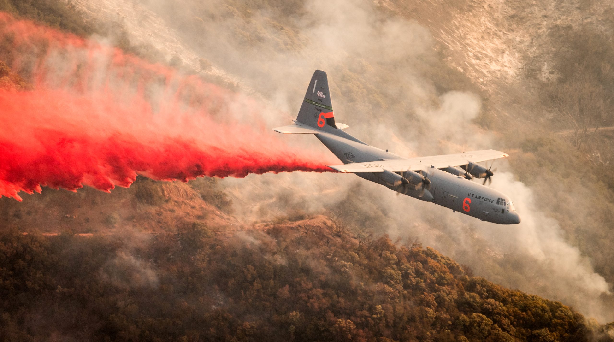 U.S. Air Force photo by J.M. Eddins Jr.
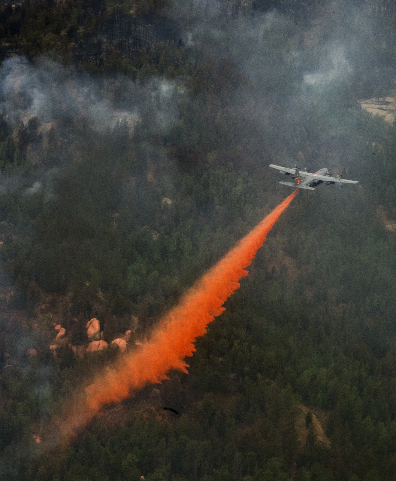 U.S. Air Force photo by Staff Sgt. Stephany D. Richards
Near misses
Not every drone ends in a collision. Many end with aircraft on the ground. In 2015, agencies documented at least 20 unauthorized drone flights over or near wildfires in six western states. Aerial firefighting was shut down temporarily on at least 12 occasions, and there were two near misses.
Source: National Parks Traveler, reporting a joint statement from wildfire agencies and the FAA.
A drone within feet of a water helicopter
A hobbyist drone came within feet of a federally contracted helicopter delivering water to the 150-acre fire. Texas A&M Forest Service said aerial firefighting can be suspended until a drone leaves, which can let a fire grow.
A helicopter had to dodge a drone
Cal Fire said a drone forced at least one helicopter to take evasive action while crews fought a fast-moving fire that threatened homes and prompted evacuations.
Four aircraft grounded for 2½ hours
A plane dropping retardant came within about 500 feet of a drone, and another pilot soon came within the same distance of a second drone. Four firefighting aircraft were grounded for 2½ hours.
Five drones over a fire that closed I-15
Five drones were sighted over a wildfire that closed Interstate 15. Crews were grounded for 20 minutes while the flames spread.
Ten feet from the windshield
A Cal Fire pilot landing seven firefighters at a park saw a drone about 10 feet from his windshield and made a hard left to avoid it, about 500 feet above the ground. He said a hit on the tail rotor would have been catastrophic.
It is not only drones
Crewed aircraft wander into fire airspace too. When one does, the aircraft working the fire have to land or leave until it is clear.
Three airspace violations
Fire officials counted three violations after the fire started Aug. 26. The most recent was a small single-engine airplane. Officials said unauthorized aircraft pose a high risk of a mid-air collision, and aircraft working the fire must return to base or the nearest helispot until the airspace is clear.
A drone, then a float plane
A drone violated the flight restriction one evening. The next day, a float plane flew directly over the helibase. Air operations were interrupted both days.
Even authorized aircraft collide
Two firefighting helicopters collided
A Bell 407 and a Sikorsky S-64E Skycrane collided over a brush fire, and the three people aboard the Bell were killed. The NTSB found the Skycrane crew entered the fire’s airspace well above its cleared altitude and then failed to see and avoid the other helicopter.
Neither aircraft was unauthorized. That is why the whole airspace needs to see everyone in it, not only the drones.
What PerimeterScope does at a fire
- Shows crewed aircraft broadcasting ADS-B or UAT, and drones broadcasting Remote ID, on one live map with weather radar underneath.
- Imports temporary flight restrictions automatically, so the fire's restricted airspace is on the map without anyone drawing it by hand.
- Alerts you when a drone appears inside or near a TFR or a geofence you set.
- Lets you whitelist your own aircraft by squawk code or tail number, so they stay quiet and the operator is not buried in alerts.
- Shows the drone operator's position when the drone broadcasts it, which can help you find the person flying it.
- Records what it sees, so there is a factual record after the incident.
PerimeterScope sees what is within line of sight of the unit. Place it near the incident command post, the helibase or wherever your aircraft are working, and use more than one unit on a large fire. It is tactically deployable, so it moves when your operation does. It comes in a rugged case that one person can set up.
What it cannot do
PerimeterScope shows what broadcasts. A drone that is not broadcasting Remote ID will not appear on the map, and FPV detection is still in development. It does not jam, block or take over anything. It is awareness only, and it supports your judgment without replacing your procedures or your command authority.
Proven in the field
Alongside Watch Duty
We ran PerimeterScope alongside Watch Duty to track the aircraft working the Hydra Fire response. Aircraft squawking 1255 showed up on Watch Duty a quarter to half a second after they crossed overhead.
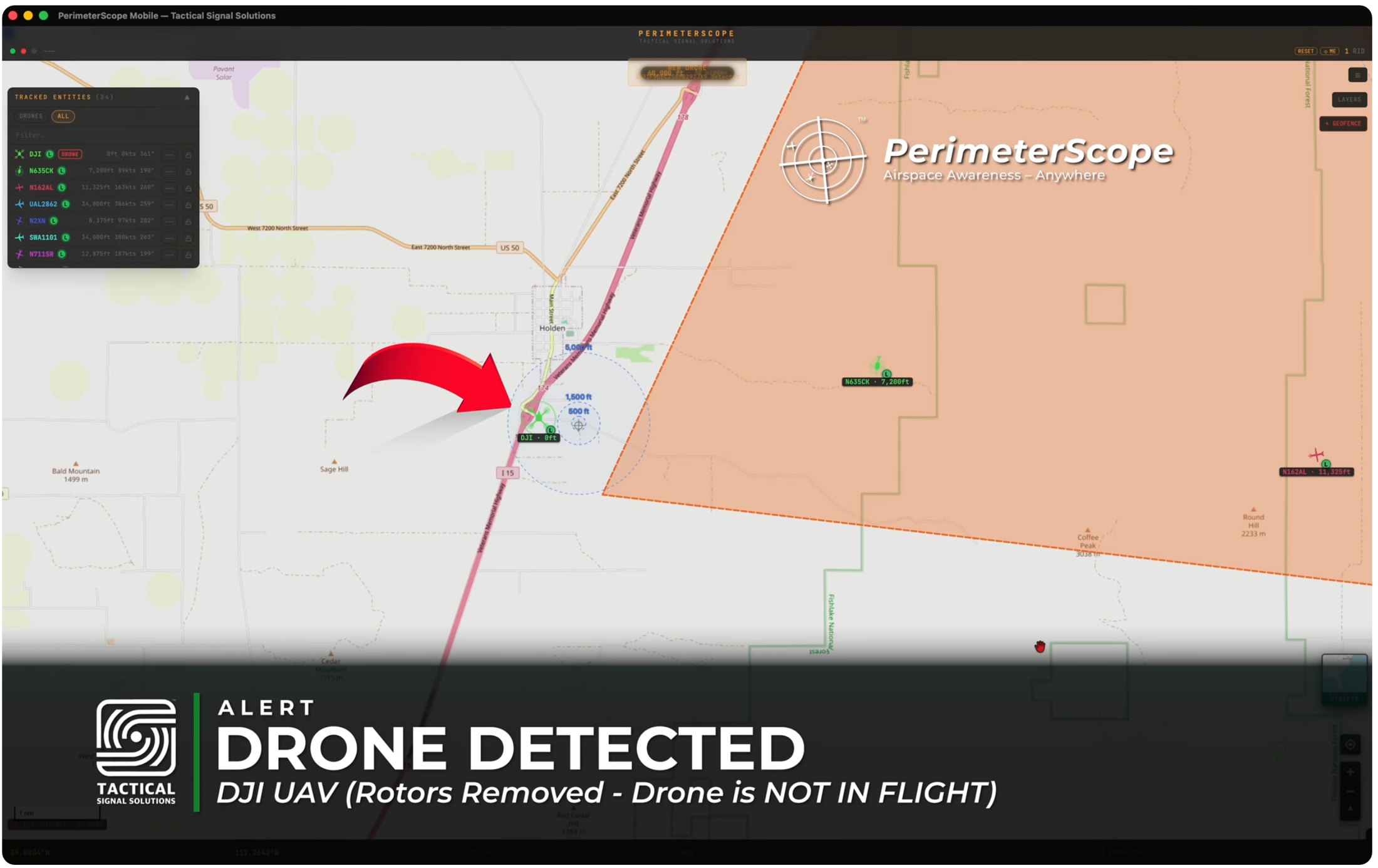
A drone alert at the TFR edge
We powered up a test drone with its rotors removed near the TFR boundary. PerimeterScope showed it on the map with an alert. The drone was not in flight.
Hydra Fire, Bosque County, Texas. PerimeterScope alongside Watch Duty.
Wild Goose Fire, Utah. Real-time airspace awareness during the fire.
 © 2026 - Tactical Signal Solutions
Status
PerimeterScope is in beta, with field validation underway, and will be available soon. An enterprise version for permanent mounting is in development.
See it running live at Disasters Expo Texas, Booth 1718. Oct. 14 and 15, George R. Brown Convention Center, Houston.