 © 2026 - Tactical Signal Solutions
October 9, 2026
By James Lea, Developer, PerimeterScope
After Hurricane Helene hit western North Carolina in late September 2024, volunteer pilots ran a large civilian airlift to reach communities the roads could not. In September and October of 2024, I was in Statesville, North Carolina, helping coordinate outbound flights for AERObridge, a nonprofit that flies relief supplies into disaster zones with volunteer pilots. Operation Airdrop and the Carolina Aviators Network were flying in and out too.
While we were working, two aircraft nearly collided in midair right over Statesville’s airport. Separately, a private plane caught fire on final approach at Rutherford County Airport on Oct. 3, 2024, and burned on the runway after its nose gear collapsed in the landing. It wasn’t an AERObridge aircraft, and thank God, the two people aboard got out with minor injuries. But for a stretch of time that felt a lot longer than it was, we didn’t know whose plane it was. We didn’t know if it was ours.
That’s the moment I think about when people ask me why I built PerimeterScope. If we’d had a unit at Statesville, I’d have known exactly which aircraft nearly collided over that airport, in seconds, not after word finally made it back to us secondhand. ADS-B and Remote ID are both line-of-sight signals, so a unit only sees what’s local to it. Rutherford County would have needed its own node to do the same for that crash. PerimeterScope is tactically deployable, so you can put a unit wherever your people are working, not just one unit covering everything.
Disaster response puts a lot of aircraft in a small piece of sky, often with no tower and no radar, run out of a command post someone stood up that morning. Add a drone to that mix and the margin gets even thinner. A drone hit a Super Scooper over the Palisades Fire in January 2025 and knocked it out of service. The Interior Department counted 53 unauthorized drone incursions over wildfires in 2025 alone, and 44 of them directly interfered with firefighting aircraft. In early August, the Spokane County Sheriff reported at least 26 drone incursions in three days, and one of them grounded every aircraft on the fire for half an hour.
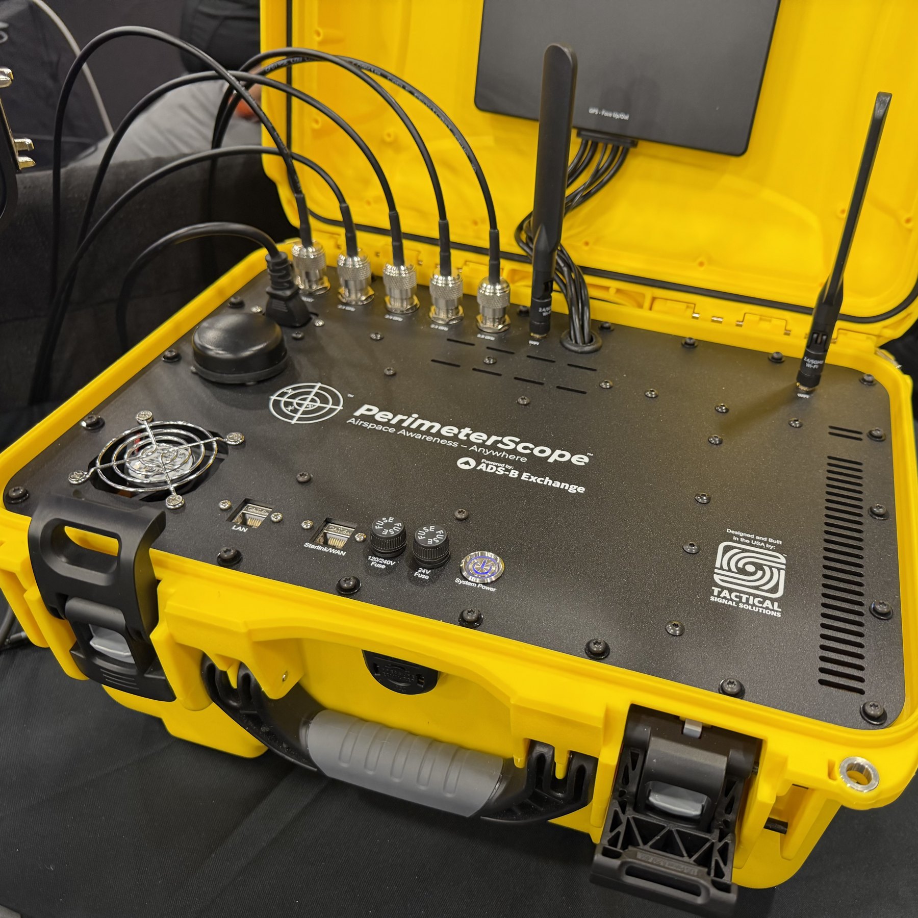
PerimeterScope is what I built so nobody else has to sit there wondering, like I did in Statesville, whose plane that is. It’s a passive, receive-only system. It listens for the ADS-B and UAT signals crewed aircraft already broadcast and the Remote ID signals drones already broadcast, and it puts all of it on one live map, right at the scene. It pulls in TFRs automatically, so you’re not drawing restricted airspace by hand in the middle of an incident. You can whitelist your own aircraft by squawk code or tail number, so the system stays quiet about the traffic you already know and flags the traffic you don’t.
It won’t see a drone that isn’t broadcasting, and we’re still working on that. It doesn’t jam anything or take control of anything. It’s not a replacement for command authority or for the procedures your agency already runs. It’s just another set of eyes on the sky, so the people making the calls have better information when they make them.
We’ve tested it in the field more than once. At the Hydra Fire in Bosque County, Texas, we ran it next to Watch Duty and timed the tankers as they crossed overhead. Watch Duty showed aircraft squawking 1255 a quarter to half a second after they passed. At the Wild Goose Fire in Utah, we powered up a drone with the rotors pulled off near the edge of the TFR, and PerimeterScope caught it and threw an alert. Near a Walmart in Red Oak, Texas, we picked up close to a dozen Zipline delivery drones in the air at once. During a Starship launch attempt that got scrubbed in June, we caught a SpaceX camera drone near the pad, inside the restricted airspace. And during FIFA events in Miami, we picked up a drone near the Fan Zone.
If you do this work, disaster response, incident command, air operations, I’d like you to see it for yourself. We’ll be at Disasters Expo Texas, Booth 1718, October 14 and 15 at the George R. Brown Convention Center in Houston, and PerimeterScope will be running live at the booth. Come ask me the hardest question you’ve got about airspace at an incident. I’ll give you a straight answer, including about what this thing still can’t do.
PerimeterScope is in beta right now, with field testing underway, and it’ll be available soon. Ask about early access at the booth, or request a demo on our site.
You can also follow along on Facebook, LinkedIn and YouTube for field tests and updates as we get closer to the show. If you work in this field, pass it along to someone on your team.
PerimeterScope is a passive airspace awareness platform developed by Tactical Signal Solutions, LLC. For a demonstration or to talk about deploying it on your incident, reach us at [email protected] or call +1 (386) 800-2553.
See how PerimeterScope can improve awareness around your operation, site, or event.
Request your demo today.
Request a Demo