By James Lea, Developer, PerimeterScope
Wildfire Today ran a guest article this week from ZenaDrone’s Usama Mehboob titled “How drones can better integrate with total incident response.” It’s a thoughtful piece, and it gets the hard part right. The strongest wildfire use of drones is likely to come from integration rather than aircraft quantity, and airspace coordination has to come before sensor capability.
Read it. Then come back, because the article names a requirement that most incidents cannot yet meet, and that requirement is the reason PerimeterScope exists.
What the article gets right
Wildfire drone operations have moved past the question of whether an unmanned aircraft can find heat or provide an overhead view. The harder problem is fitting another aircraft and another data stream into an incident that already involves helicopters, air tankers, lead planes, ground crews and changing airspace restrictions.
The author lays out four operating priorities: define operating areas and altitude limits before launch, keep direct coordination between UAS personnel and incident aviation staff, recheck TFR and NOTAM information as conditions change, and give aviation supervisors clear authority to stop unmanned flights when crewed aircraft need the airspace.
Every one of those is correct. The fourth one is where the article stops short.
The gap: authority is not awareness
Giving an aviation supervisor the authority to ground a drone assumes the supervisor knows the drone is there, knows where it is, and knows where it is relative to the tanker that just checked in on final.
On most incidents today, that knowledge comes from a radio call, a briefed operating box on a map, and trust. It is a snapshot. The drone was at a certain location at a certain altitude when the pilot reported in. Whether it is still there thirty seconds later is unknown to everyone except the drone pilot, and the drone pilot may not be able to see the helicopter coming around the ridge.
Meanwhile, the unauthorized drone, the hobbyist who launched from a driveway inside the TFR to get footage of the column, is invisible to the aviation structure entirely. The first person to see that aircraft is usually a pilot, and by then the only option is to clear the airspace and hold everything on the ground until it can be confirmed clear.
The article makes the point that a technically successful mission can become an operational problem if the aircraft location, altitude or flight window conflicts with a helicopter or tanker assignment. That’s exactly right. The question is how anyone would know about the conflict before it becomes a near miss.
What deconfliction actually requires
Real airspace deconfliction on a wildfire requires a shared, live picture that answers three questions at any moment:
- Where is every crewed aircraft working the incident?
- Where is every drone, authorized or not, that is broadcasting its position?
- Are any of them about to occupy the same airspace?
Crewed firefighting aircraft already broadcast their position via ADS-B, and they squawk 1255, the transponder code assigned to aircraft working over a fire. Since the FAA’s Remote ID rule took effect, most drones flying in the United States are required to broadcast their identity, position, and control station location as well. The data to build that shared picture is already in the air. What has been missing is a way to receive both streams, in the field, on one screen.
Where PerimeterScope fits
PerimeterScope is a passive, receive-only airspace awareness platform. It listens for ADS-B from crewed aircraft and Remote ID from drones and displays both together, live, at the incident.
For the people the article is written for, that means:
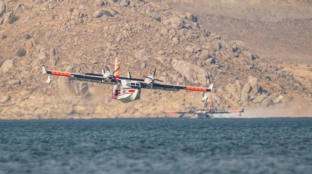
Air attack and the incident aviation staff see the same picture. Tanker on final, Scooper cycling to the lake, helicopter working buckets on the flank, and the authorized public safety drone holding in its briefed box, all on one display with no lag between “where the drone said it was” and “where the drone is.”
The UAS coordinator can confirm their aircraft is where it’s supposed to be, and see the crewed traffic it needs to stay clear of, without adding radio load.
The aviation supervisor with the authority to ground drone operations now has the awareness to exercise that authority at the moment it matters, rather than after a pilot reports a sighting.
Unauthorized drones broadcasting Remote ID appear alongside the crewed traffic the instant they power on inside receiving range, with their control station location, so incident staff can act while the aircraft is still on the ground or barely airborne, not after a tanker has already had to break off.
PerimeterScope detections can also be published to ADS-B Exchange, which means what the platform sees at the incident can be independently verified on a public feed rather than taken on faith.
Field validation at the Hydra Fire
On September 16, 2026, we ran PerimeterScope at the Hydra Fire in Bosque County, Texas, during active air operations under a TFR, and recorded it alongside Watch Duty for direct comparison.
Watch Duty pulls its aircraft feed from ADS-B Exchange and filters it down to firefighting aircraft, so it is a fair benchmark for the crewed traffic that matters most on a fire. Every aircraft PerimeterScope received that was squawking 1255 appeared on Watch Duty within milliseconds. Same aircraft, same positions, same moment.
Aircraft observed during the recording included Bridger Aerospace Super Scoopers SCPR261, SCPR263, SCPR281, and SCPR285; Neptune Aviation’s TKR01 and TKR02 (BAe 146); a Chinook operating as TANDM05; an H-60, N115; a King Air 200 operating as FRLD274; N613TA; and several others.
PerimeterScope was also displaying the traffic Watch Duty filters out. That is the point. A public tracker shows the fire community which firefighting aircraft are working. Deconfliction requires seeing everything else that is sharing the airspace with them.
The full overlay video is available on our YouTube channel.
What PerimeterScope is not
Because this space attracts a lot of overpromising, it’s worth being direct about limits.
PerimeterScope does not transmit. It does not jam, spoof, take over, or otherwise interfere with any aircraft or drone. It is not a counter-UAS system and does not perform mitigation of any kind.
PerimeterScope displays drones that are broadcasting Remote ID and aircraft that are broadcasting ADS-B. A drone that has been modified to disable Remote ID, or that is exempt from the requirement, will not appear. We consider that a feature of honest engineering rather than a gap to paper over: the platform shows you exactly what is announcing itself in your airspace, and nothing it cannot verify.
The article’s closing point, extended
The Wildfire Today piece closes by saying that wildfire response does not need drones flying simply because they are available. It needs missions with a defined purpose, controlled access to the airspace and a direct connection between observation and action.
We’d add one line. Controlled access to the airspace requires being able to see who is in it. PerimeterScope gives the people who already hold the authority the awareness to use it.
PerimeterScope is a passive airspace awareness platform developed by Tactical Signal Solutions, LLC. For a demonstration or to discuss deployment on your incident, contact [email protected] or call us at +1 (386) 800-2553
See how PerimeterScope can improve awareness around your operation, site, or event.
Request your demo today.
Request a Demo